
On the Move: How New York Mammals Navigate Our Landscape
Picture a bobcat finding her way through the dark before dawn. She moves without a sound, each paw placed with precision as she follows the same creek bottom she's used a hundred times before, most likely the same route worn into the hillside by generations of paws before hers. She steps lightly across a mossy downed tree that spans the stream, pauses to read the air with her nose, and slips into the hemlocks on the other side. She has no idea she just crossed a wildlife ecologist's dream: a natural wildlife funnel doing exactly what it's supposed to do. This is wildlife movement, and for the mammals of New York State, it's both an ancient behavior and an increasingly urgent challenge.
Why Movement Matters
Wildlife don't experience the landscape the same way we do. We see the world as a patchwork of parks, forests, farms, public and private properties, buildings and roads. For a fisher hunting a forest edge, a bobcat establishing a new territory, or a black bear searching for a mate, the landscape is a continuous fabric of habitat that they must be able to move through to survive. This movement isn't optional. Animals travel to find food, water, shelter, and mates. Young animals disperse from where they were born to establish territories of their own. When populations are isolated from one another, inbreeding weakens genetic health, and local extinctions can't be replenished from neighboring populations. In a rapidly changing climate, movement becomes even more critical. Species need to shift their ranges to find more suitable conditions, and they can only do that if the landscape lets them.
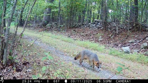
New York mammals like white-tailed deer, black bear, bobcat, river otter, fisher, moose, coyote, beaver, mink, red and gray fox, striped skunk, porcupine, snowshoe hare, and dozens more — all depend on connected landscapes to sustain healthy populations. Some, like the black bear, may travel dozens of miles establishing a home range. Others, like the short-tailed weasel, may spend their entire lives within a few acres. But all of them are shaped by whether the landscape around them is connected or broken.
Barriers: The Obstacles Wildlife Face
The biggest challenge facing wildlife movement today is fragmentation, which is the breaking up of continuous habitat into smaller, isolated pieces. Roads are the most obvious culprit. A busy highway isn't just a physical barrier; the noise, lights, and traffic create what biologists call an "ecological trap" that animals avoid or die trying to cross. In New York State alone, thousands of deer, raccoons, opossums and other mammals are killed on roads each year. But roads aren't the only barriers. Development removes habitat outright. Agricultural fields can be difficult for forest-dependent species to traverse. Even streams,which animals use as natural travel corridors, can become obstacles when they're channelized, culverted, or when bridges are built with no room for an animal to pass through on dry ground alongside the water. Mountains can concentrate and direct movement rather than block it, funneling animals through gaps and passes. Knowing where these natural pinch points are, and protecting them, is one of the most powerful things conservationists can do.
The Power of a Crossing
When wildlife can't go around a barrier, they need a way through it. Wildlife crossings, overpasses, underpasses, and culverts designed with wildlife in mind, and naturally occurring features like downed logs over streams, dramatically reduce road mortality and reconnect fragmented populations. Here in New York, these crossings don't have to be elaborate engineered structures to be effective. A large culvert with a dry ledge inside, a bridge with naturalized banks underneath, or a log that has fallen across a stream can all serve as critical connectors. Animals learn these crossing points and use them repeatedly. Over time, individuals from different populations begin to intermingle, genes flow, populations stabilize, and the landscape becomes, in a functional sense, whole again.


Big Picture: The WNY Wildway and the A2A Corridor
Two major conservation initiatives are working to maintain and restore wildlife connectivity right here in New York, at dramatically different scales, and both have direct relevance to the mammals you may be photographing through Snapshot NY.
The Western New York Wildway, led by the Western New York Land Conservancy, is an ambitious landscape-scale conservation initiative launched in 2020. The vision is an extensive connected series of protected lands stretching from the vast forests of northern Pennsylvania all the way to the Great Lakes, linking up with the broader Eastern Wildway network. The WNY Wildway spans all eight counties of western New York: Allegany, Cattaraugus, Chautauqua, Erie, Genesee, Niagara, Orleans, and Wyoming. The driving concept is that a connected landscape sustains biodiversity, allows wildlife to move freely, safeguards water resources, and helps species adapt as the climate changes.
At an even broader scale, theAlgonquin to Adirondacks (A2A) Collaborative is working to heal and reconnect landscapes across one of the last remaining large-scale intact forest and wetland linkages in Eastern North America. Their corridor runs between Algonquin Provincial Park in Ontario and Adirondack Park in northern New York, a region of enormous importance for mammals like moose, black bear, bobcat, fisher, and more. Roads, development, and the international border have severed ancient migratory pathways that wildlife once used freely. The A2A has spent over two decades studying where animals are most at risk, particularly along barriers like Ontario's Highway 401, to advocate for wildlife crossings and restored connectivity. Their work in the Adirondacks and St. Lawrence corridor is directly relevant to many of the species showing up on Snapshot NY cameras across northern and central New York.
The story of Alice the Moose captures why this work matters so viscerally. In 1998, a 700-pound female moose was collared and released in Adirondack Park. Over two years she traveled more than 570 kilometers, eventually swimming the St. Lawrence River, crossing a four-lane highway, and walking all the way to Algonquin Park — proving that the A2A corridor is not just an idea, but a living pathway that wildlife are already using, if we give them the chance.
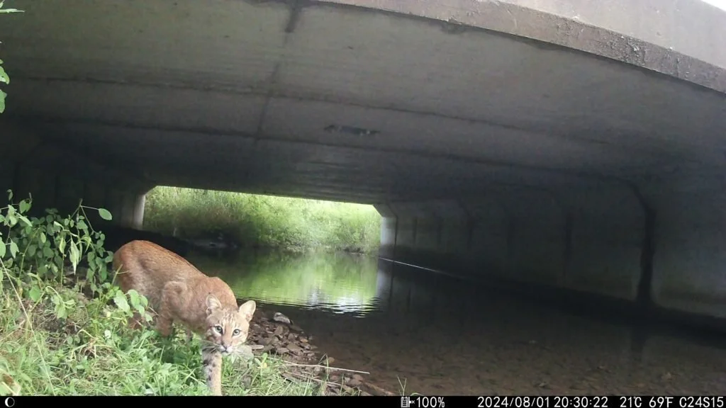
Image from the Western NY Wildway project - Marcus Rosten
Where Cameras Meet Corridors: Snapshot NY and Natural Funnels
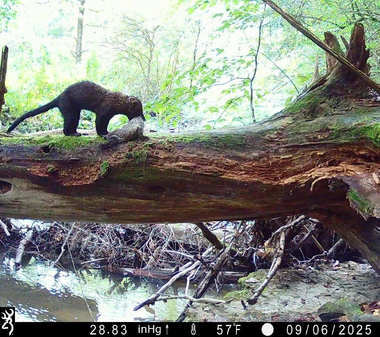
This is where Snapshot NY comes in. When you place a trail camera thoughtfully, you're essentially tapping into the same logic that wildlife crossings are designed around. Animals are creatures of habit and efficiency. They follow paths of least resistance: game trails worn smooth by repeated use, stream corridors that provide cover and water, ridgelines that serve as travel routes, and natural crossing points like fallen logs over streams and shallow riffles.
A downed log spanning a creek might look like woodland debris to us. To a mink, a weasel, an otter, or a bobcat, it's a bridge. A reliable, repeated crossing point that gets used by dozens of animals over the course of a season. When you position a camera at one of these natural funnels, you're not just capturing individual animals. You're documenting wildlife movement ecology in real time: which species use the crossing, in what order, at what times of day, and in what seasons.
The trail camera photos we have of mammals using downed logs as stream crossings are a perfect illustration of this principle. That log isn't random. Animals chose it. They chose it because it solves a problem; how to cross a barrier efficiently, and once a few individuals discover it, others follow. The scent marks left behind, the worn bark, the trail leading to each bank. These are the signatures of a functional wildlife corridor, operating at the smallest, most intimate scale.
Game trails work the same way. An established trail through a forest isn't just a path; it's a record of how animals have mapped the landscape around them. It runs where it does because something makes that route advantageous like topography, cover, and proximity to food or water. This is the same thinking that guides researchers and engineers when they design formal wildlife crossings: find where animals want to go, remove the barrier, and let the movement happen.
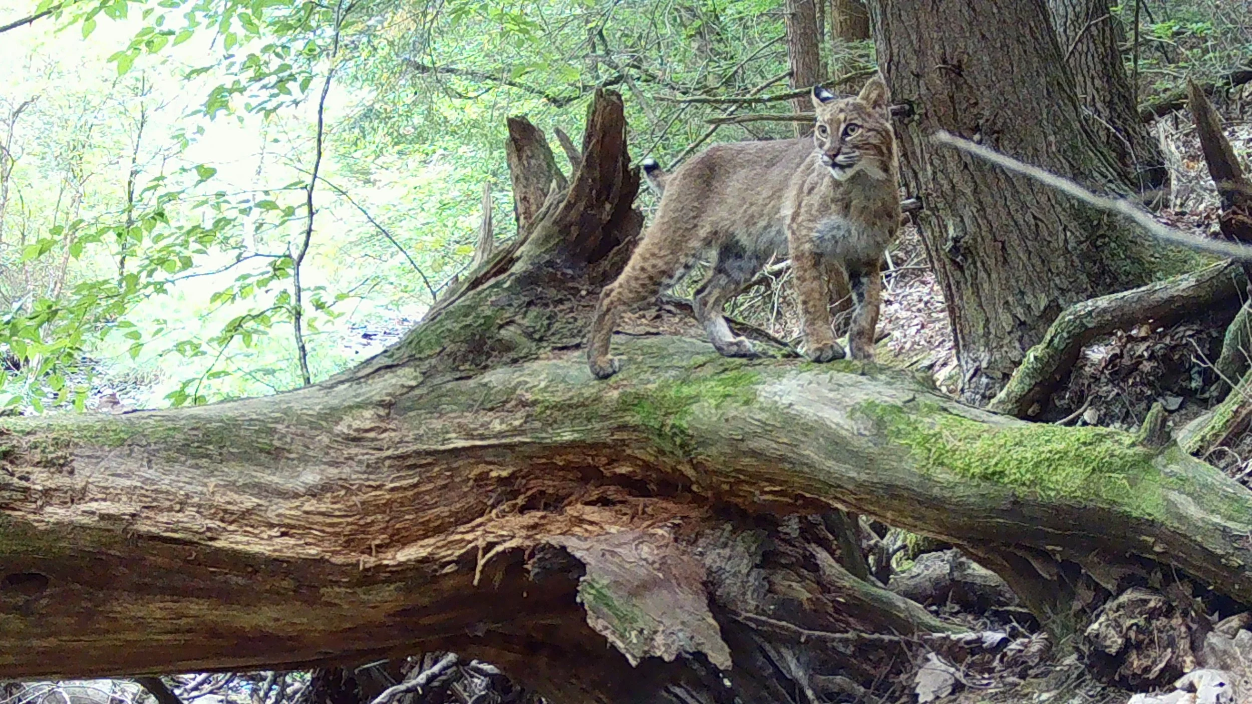
Image captured on a Snapshot NY volunteers trail camera
What You Can Do
When you're choosing a camera location, think like a corridor ecologist. Look for the pinch points in the landscape. The places where topography or vegetation funnel movement. Find the stream crossings, the gap in the fence, the trail that parallels the creek. These are the spots where wildlife are most predictable, most concentrated, and most likely to give you a meaningful image. When you submit your Snapshot NY photos, you're contributing data that matters beyond species identification. Patterns of camera detections across the landscape reveal where animals are moving, which crossing points they're using, and where barriers may be breaking connectivity. That information could directly inform conservation decisions like where to prioritize land protection, where a culvert replacement might reconnect a fragmented population.
The mammals of New York are on the move and they always have been! Our job a, as citizen scientists, researchers, biologists, managers, and people who care about wild places, is to understand that movement, document it, and help make sure the landscape stays connected enough to allow it.
Learn more about the Western New York Wildway at wnylc.org/wnywildway and the Algonquin to Adirondacks Collaborative at a2acollaborative.org.